Androscoggin County, Maine
Template:Short description Template:Use mdy dates Template:Infobox U.S. county
Androscoggin County (French: Comté d'Androscoggin) is a county in the U.S. state of Maine. As of the 2020 census, the county's population was 111,139.<ref>Template:Cite web</ref> Its county seat is Auburn and its most populous city is Lewiston.<ref name="GR6">Template:Cite web</ref>
Androscoggin County comprises the Lewiston-Auburn, Maine metropolitan statistical area and is partially included in the Lewiston-Auburn, Maine, Metropolitan New England City and Town Area. It is also a part of the Portland-Lewiston-South Portland, Maine combined statistical area.
Bates College is in the Androscoggin County city of Lewiston.
History
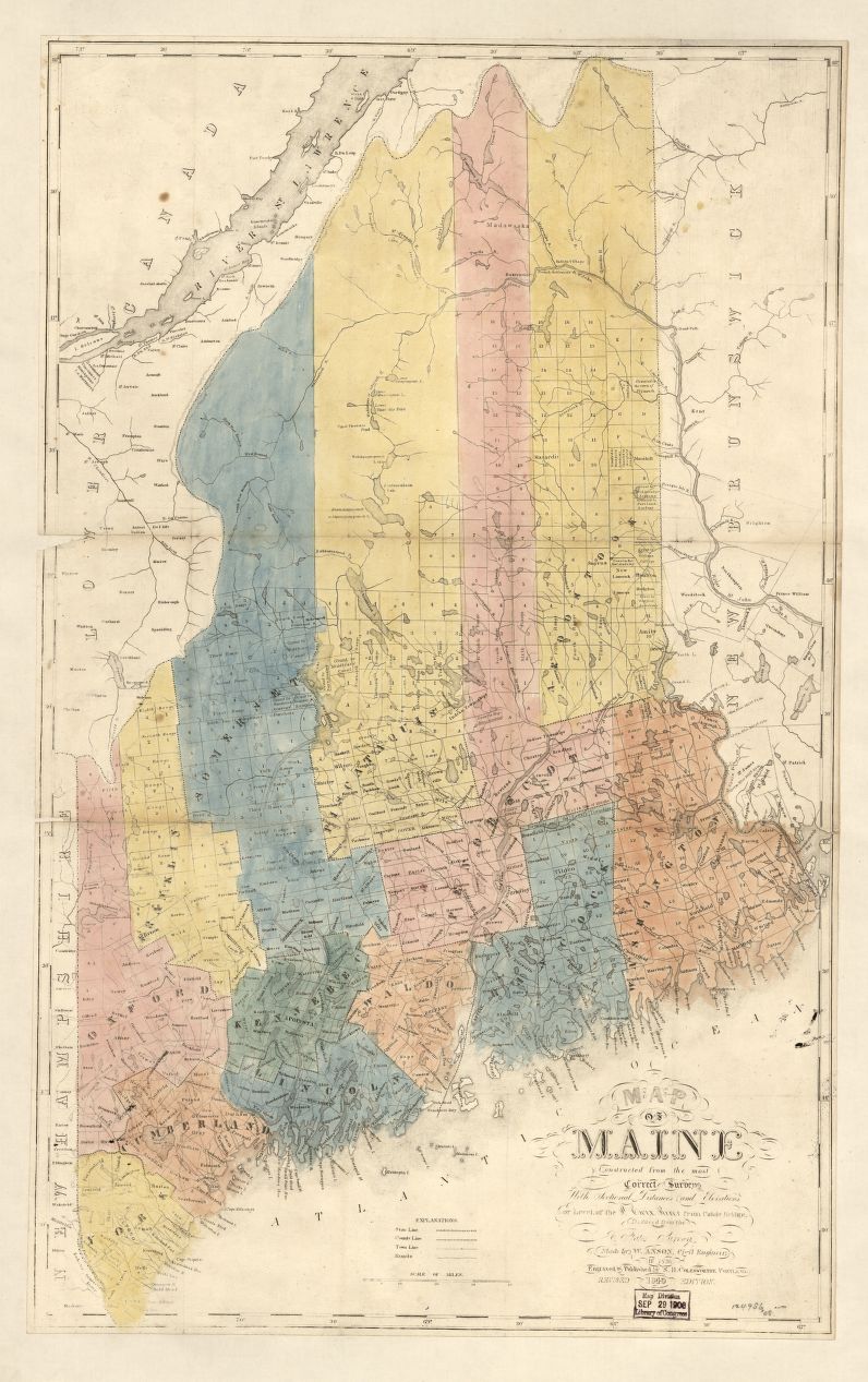
[edit]Demand for a new county emerged when the residents of the rapidly growing town of Lewiston complained of the long distance they had to travel to reach Wiscasset, the county seat of Lincoln County, in which Lewiston was originally located. It was also an impractical circumstance as Lewiston's neighbor, Auburn, was part of Cumberland County. As the growing partnership of the two towns emerged, the case for the towns to be in the same county grew. Different plans were discussed, including Lewiston joining Cumberland County. Eventually, the idea of a new county came to the table. The debate then became over which town would be the center of the new county. Bath, Brunswick, and Lewiston each desired the distinction. Lewiston eventually won the debate. Androscoggin County was created in 1854 from towns originally in Cumberland County, Lincoln County, Kennebec County, and Oxford County.<ref>1840 Map of Maine Counties with Town Boundaries. Accessed July 2021.</ref>
The next issue centered on where to put the county seat, as both Lewiston and Auburn desired to be named the county seat. It would eventually be put to a vote, with both towns putting different offers on the table, including ideas to cut the costs of the new county buildings for surrounding towns. Auburn would eventually win a convincing victory, with the towns on each side of the river voting for the town on their side. As more people then lived to the west of the Androscoggin River, Auburn won the vote.<ref>Hodgkin, Douglas I., Frontier to Industrial City:Lewiston Town Politics 1768–1863. Just Write Books, Topsham, Maine, 2008</ref>
Geography
[edit]According to the U.S. Census Bureau, the county has a total area of Template:Convert, of which Template:Convert is land and Template:Convert (5.9%) is water.<ref name="GR1">Template:Cite web</ref> It is the second-smallest county in Maine by total area, after neighboring Sagadahoc County.
The Androscoggin River flows through the center of the county, as well as forming a short part of the county line with Sagadahoc County in the south. The Androscoggin Riverlands State Park lies along the river, north of Auburn. The county is also the site of Poland Spring, the original source of the bottled water brand bearing its name.
Adjacent counties
[edit]- Franklin County – north
- Kennebec County – northeast
- Sagadahoc County – southeast
- Cumberland County – south
- Oxford County – west
Major highways
[edit]- Template:Jct
- Template:Jct
- Template:Jct
- Template:Jct
- Template:Jct
- Template:Jct
- Template:Jct
- Template:Jct
- Template:Jct
- Template:Jct
- Template:Jct
- Template:Jct
- Template:Jct
- Template:Jct
- Template:Jct
- Template:Jct
- Template:Jct
Demographics
[edit]2010 census
[edit]At the 2010 census, there were 107,702 people, 44,315 households, and 28,045 families living in the county.<ref name="census-dp1">Template:Cite web</ref> The population density was Template:Convert. There were 49,090 housing units at an average density of Template:Convert.<ref name="census-density">Template:Cite web</ref> The racial makeup of the county was 92.8% white, 3.6% black or African American, 0.7% Asian, 0.4% American Indian, 0.4% from other races, and 2.0% from two or more races. Those of Hispanic or Latino origin made up 1.5% of the population.<ref name="census-dp1"/> The largest ancestry groups were as follows: 21.2% cited English ancestry, 20.5% French Canadian, 20.1% French (not counted in the previous group), 15.5% Irish, 8.1% German, and 5.0% American.<ref name="census-dp2">Template:Cite web</ref>
Of the 44,315 households, 30.2% had children under the age of 18 living with them, 45.8% were married couples living together, 12.0% had a female householder with no husband present, 36.7% were non-families, and 28.3% of households were made up of individuals. The average household size was 2.37 and the average family size was 2.88. The median age was 39.8 years.<ref name="census-dp1"/>
The median household income was $44,470 and the median family income was $55,045. Males had a median income of $41,554 versus $31,852 for females. The per capita income for the county was $22,752. About 9.7% of families and 14.3% of the population were below the poverty line, including 20.0% of those under age 18 and 12.4% of those age 65 or over.<ref name="census-dp3">Template:Cite web</ref>
2020 census
[edit]At the 2020 census, there were 111,132 people and 45,825 households living in the county.<ref>Template:Cite web</ref> The population density was Template:Convert inhabitants per square mile. There were 50,844 housing units at a density of Template:Convert. The racial makeup of the county was 90.6% white, 5.4% black or African American, 1.1% Asian, and 2.0% from two or more races. Those of Hispanic or Latino origin accounted for 2.2% of the population. The largest ancestry groups were: 19.7% English, 18.6% French, 14.6% Irish, 5.7% German, 4.7% Italian, 3.7% Scottish, and 2.1% Subsaharan African.<ref>Template:Cite web</ref> 10.6% of the population over age 5 spoke a language other than English at home.<ref>Template:Cite web</ref>
The median household income was $64,500, and $73,029 for families. The per capita income was $34,273. At 12.7%, Androscoggin County has a poverty rate nearly 2% higher than the state as a whole. The poverty rate for those under 18 was 19.4% and 8.5% for individuals aged 65 and over.<ref>Template:Cite web</ref>
Media
[edit]Newspapers
[edit]- The Sun Journal prints a daily newspaper in four different editions statewide. The Sun Journal was the recipient of the 2008 New England Daily Newspaper of the Year and the 2009 Maine Press Association Newspaper of the Year.
Politics
[edit]Presidential elections
[edit]In presidential elections, Androscoggin County is considered a "swing area" by most political standards, with a fairly even split between Democratic and Republican voters. It was the only county in Maine to be won by Democrats Franklin D. Roosevelt in 1932 and George McGovern in 1972. Jimmy Carter also carried the county twice. In 1984 and 1988, it went for Republican candidates Ronald Reagan and George H.W. Bush, who also won the state of Maine. However, the county swayed in favor of Republican Donald Trump for both the 2016 and 2020 elections;<ref>David Leip's Presidential Atlas (Maps for Maine by election)</ref> even as the state as a whole was won by Democrats Hillary Clinton and Joe Biden, respectively.<ref>Template:Citation</ref> In 2024 Trump carried the county again, this time by an even larger margin, the strongest showing for a Republican since 1984.
Template:PresHead Template:PresRow Template:PresRow Template:PresRow Template:PresRow Template:PresRow Template:PresRow Template:PresRow Template:PresRow Template:PresRow Template:PresRow Template:PresRow Template:PresRow Template:PresRow Template:PresRow Template:PresRow Template:PresRow Template:PresRow Template:PresRow Template:PresRow Template:PresRow Template:PresRow Template:PresRow Template:PresRow Template:PresRow Template:PresRow Template:PresRow Template:PresRow Template:PresRow Template:PresRow Template:PresRow Template:PresRow Template:PresRow Template:PresRow Template:PresRow Template:PresRow Template:PresRow Template:PresRow Template:PresRow Template:PresRow Template:PresRow Template:PresRow Template:PresRow Template:PresRow |}
State politics
[edit]In 2012, the county voted 54% against Maine Question 1, 2012 – a measure to legalize same-sex marriage, but the referendum passed in the state with 53%.<ref>Template:Cite web</ref>
County government
[edit]Androscoggin County is governed by an elected county commission consisting of seven members representing single-member districts.<ref>Template:Cite web</ref> Currently, the county commissioners are:
Voter registration
[edit]| Active voter registration and party enrollment as of March 2024<ref name="Maine SOS">Template:Cite web</ref> | |||||
|---|---|---|---|---|---|
| Template:Party color cell | Democratic | 22,352 | Template:Percentage | ||
| Template:Party color cell | Republican | 20,684 | Template:Percentage | ||
| Template:Party color cell | Unenrolled | 19,664 | Template:Percentage | ||
| Template:Party color cell | Green Independent | 3,199 | Template:Percentage | ||
| Template:Party color cell | Libertarian | 1,403 | Template:Percentage | ||
| Template:Party color cell | No Labels | 1,397 | Template:Percentage | ||
| Total | 68,699 | Template:Percentage | |||
Communities
[edit]Incorporated towns and cities
[edit]- Auburn
- Durham
- Greene
- Leeds
- Lewiston
- Lisbon
- Livermore
- Livermore Falls
- Mechanic Falls
- Minot
- Poland
- Sabattus
- Turner
- Wales
Census-designated places
[edit]Economy
[edit]Some agriculture exists here.<ref name="2017-Census" /> Androscoggin is especially known for poultry Template:Endash ranking #1 in the state for the poultry and egg category<ref name="2017-Census" /> from 77 producing farms.<ref name="census-2017">Template:Cite web</ref> The county is also top in the state for hog and pig production.<ref name="2017-Census">Template:Cite web</ref> Template:Clear
See also
[edit]- Androscoggin Creature
- Lewiston shootings, which took place in the county in 2023
- Lisbon School Department
- National Register of Historic Places listings in Androscoggin County, Maine
References
[edit]Further reading
[edit]External links
[edit]- Androscoggin County Chamber of Commerce
- Maine Local Government – County of Androscoggin page
- Maine State Library's Digital Maine Repository. Items related to Androscoggin County
- Digital Public Library of America. Assorted materials related to Androscoggin County
Template:Geographic Location Template:Androscoggin County, Maine Template:Maine Template:Authority control