Moody County, South Dakota
Template:Short description Template:Use mdy dates Template:Infobox U.S. county
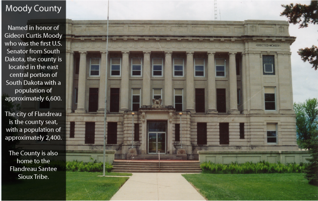
Moody County is a county in the U.S. state of South Dakota, United States. The population was 6,336 at the 2020 census.<ref name="QF">Template:Cite web</ref> Its county seat is Flandreau.<ref>Template:Cite web</ref> The county is named for Gideon C. Moody.<ref>Homepage at MoodyCounty.net; published 2011; retrieved January 9, 2014</ref>
Geography
[edit]Moody County lies on the east side of South Dakota. Its east boundary line abuts the west boundary line of the state of Minnesota. The Big Sioux River flows southerly through the center of the county. Its terrain consists of rolling hills, devoted to agriculture, with lakes in the western portion.<ref name="MCSD">Template:Cite web</ref> The terrain slopes to the south, with its high point near its northeast corner, at Template:Convert ASL, although the east and west sides also slope into the river valley through the center of the county.<ref>Template:Cite web</ref> The county has a total area of Template:Convert, of which Template:Convert is land and Template:Convert (0.3%) is water.<ref>Template:Cite web</ref>
Major highways
[edit]- File:I-29.svg Interstate 29
- File:SD 11.svg South Dakota Highway 11
- File:SD 13.svg South Dakota Highway 13
- File:SD 32.svg South Dakota Highway 32
- File:SD 34.svg South Dakota Highway 34
Adjacent counties
[edit]- Brookings County - north
- Lincoln County, Minnesota - northeast
- Pipestone County, Minnesota - east
- Rock County, Minnesota - southeast
- Minnehaha County - south
- Lake County - west
Lakes
[edit]- Anderson Slough
- Lake Campbell (part)
- Mud Lake
- Poison Lake
- Bull Slough<ref name=MCSD/>
Protected areas
[edit]- Anderson Slough State Game Production Area
- Boles Slough State Game Production Area
- Gideon State Game Production Area
- Hazels Haven State Game Production Area
- Kamp State Game Production Area
- Olson Lake State Game Production Area<ref name=MCSD/>
Demographics
[edit]2020 census
[edit]As of the 2020 census, there were 6,336 people, 2,474 households, and 1,685 families residing in the county.<ref>Template:Cite web</ref> The population density was Template:Convert. There were 2,728 housing units.
2010 census
[edit]As of the 2010 census, there were 6,486 people, 2,554 households, and 1,751 families in the county. The population density was Template:Convert. There were 2,824 housing units at an average density of Template:Convert. The racial makeup of the county was 81.0% white, 14.0% American Indian, 1.1% Asian, 0.5% black or African American, 0.7% from other races, and 2.7% from two or more races. Those of Hispanic or Latino origin made up 1.7% of the population. In terms of ancestry, 39.9% were German, 20.1% were Norwegian, 8.9% were Irish, 6.1% were Dutch, 5.1% were English, and 1.6% were American.
Of the 2,554 households, 30.9% had children under the age of 18 living with them, 54.3% were married couples living together, 8.8% had a female householder with no husband present, 31.4% were non-families, and 27.4% of all households were made up of individuals. The average household size was 2.48 and the average family size was 3.00. The median age was 40.5 years.
The median income for a household in the county was $52,354 and the median income for a family was $61,667. Males had a median income of $36,364 versus $30,854 for females. The per capita income for the county was $24,948. About 4.7% of families and 7.1% of the population were below the poverty line, including 8.8% of those under age 18 and 13.1% of those age 65 or over.
Communities
[edit]Cities
[edit]Towns
[edit]Census-designated place
[edit]Unincorporated community
[edit]- Lone Tree
Townships
[edit]- Alliance
- Blinsmon
- Clare
- Colman
- Egan
- Enterprise
- Flandreau
- Fremont
- Grovena
- Jefferson
- Lone Rock
- Lynn
- Riverview
- Spring Creek
- Union
- Ward
Politics
[edit]Moody County voters tend to split between the two major political parties. Between 1960 and 2012, the national election results in Moody County were almost always evenly split. Since 2016, the county has started supporting Republican candidates more strongly. Template:PresHead Template:PresRow Template:PresRow Template:PresRow Template:PresRow Template:PresRow Template:PresRow Template:PresRow Template:PresRow Template:PresRow Template:PresRow Template:PresRow Template:PresRow Template:PresRow Template:PresRow Template:PresRow Template:PresRow Template:PresRow Template:PresRow Template:PresRow Template:PresRow Template:PresRow Template:PresRow Template:PresRow Template:PresRow Template:PresRow Template:PresRow Template:PresRow Template:PresRow Template:PresRow Template:PresRow Template:PresRow Template:PresRow Template:PresRow Template:PresFoot
See also
[edit]References
[edit]External links
[edit]Template:Geographic Location Template:Moody County, South Dakota Template:SouthDakota Template:Authority control